The 26.2 miles of pavement spanning the New York City Marathon represent far more than an annual endurance race or civic celebration. Every November, over 55,000 runners execute an operational stress test across all five boroughs, creating a live cross-section of the city’s economic machinery. Delivering over $690 million in direct annual economic output, the race course offers a clear lens into how transit connectivity, zoning density, and neighborhood desirability shape property valuations across the metropolis.
The journey begins at Fort Wadsworth beneath the Verrazzano-Narrows Bridge on Staten Island. While the borough serves as the geographical launchpad for the course, its real estate ecosystem operates on a distinct cadence from the rest of the city. Staten Island anchors the route with the highest homeownership rate in New York at roughly 66 percent, dominated by single-family detached properties and low-density townhouses. With median sales prices hovering around $675,000, the borough presents a substantial value baseline compared to cross-bridge neighborhoods. The North Shore corridor, stretching from St. George down toward Rosebank, remains the core focus for multi-family redevelopments where transit-oriented projects near the Staten Island Ferry terminal target buyers seeking space and waterfront views at price points under $800 per square foot.
Crossing the bridge into Brooklyn, the course covers nearly half its total distance through Bay Ridge, Sunset Park, Gowanus, Park Slope, Williamsburg, and Greenpoint. This extended stretch captures the full narrative of Brooklyn’s residential evolution. In southern Brooklyn, Bay Ridge and Sunset Park offer stable co-op communities and two-family brick homes trading between $620,000 and $850,000, supported by deep end-user demand and ferry service. Moving north into Park Slope and Williamsburg, historic brownstones and luxury waterfront glass towers push median condo prices well past $1.5 million to over $2,000 per square foot. The corridor through Gowanus highlights the structural impact of large-scale rezonings, where industrial parcels along First and Third Avenues continue transforming into high-density rental stock supported by sub-four percent vacancy rates.
Crossing the Pulaski Bridge brings runners to the midpoint in Long Island City, Queens. This segment showcases hyper-dense urban planning adjacent to traditional low-rise working-class neighborhoods. Long Island City stands out as one of the densest submarkets for recent residential completions in the entire city. Positioned just one subway stop from Midtown Manhattan, modern glass towers in Court Square and Hunter’s Point command premium rental rates exceeding $4,200 per month and condo prices ranging from $1,300 to $1,600 per square foot. The area acts as a vital housing relief valve for Manhattan while maintaining its own thriving commercial identity.
After traversing the Queensboro Bridge, the route spills onto First Avenue in Manhattan, entering a high-density vertical arterial. The Upper East Side portion along First Avenue features a dense mix of post-war doorman buildings and pre-war walk-ups, where proximity to transit networks supports condo values around $1,400 to $1,700 per square foot. As the course moves past 96th Street into East Harlem, the avenue transitions into an active development zone for ground-up, mixed-income rental projects. Institutional investors target this stretch due to accessible land basis costs and favorable tax structures, offering entry price points between $900 and $1,100 per square foot.
A short trip across the Willis Avenue Bridge takes the race into the South Bronx for a fast, energetic mile through Mott Haven. Historically an industrial district, Mott Haven represents one of the most rapidly evolving real estate frontiers in the city. The Harlem River waterfront has seen significant capital deployment, introducing thousands of new luxury rental units where studios and one-bedrooms command between $2,600 and $3,400 per month. Multi-family assets and historic townhouses in the Mott Haven Historic District draw strong institutional interest, offering cap rates fifty to one hundred basis points wider than comparable Brooklyn properties.
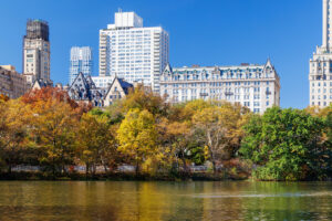
The final leg descends Fifth Avenue through Harlem and Museum Mile before entering Central Park for the finish line near West 67th Street. This closing stretch traverses some of the most exclusive real estate in the world. Pre-war co-ops and ultra-prime condos along Fifth Avenue and Central Park South command valuation premiums from $2,500 to well over $5,000 per square foot, reaching up to $10,000 per square foot for super-prime trophy residences. These closing miles underline the structural supply constraints of prime Manhattan real estate, where limited land availability maintains global demand and long-term capital preservation regardless of broader economic cycles.
The full course demonstrates that New York City does not function as a single, uniform real estate market. Instead, those 26.2 miles link a series of highly specialized micro-markets, each valued according to its transit access, zoning framework, and physical limits of supply.